AI-Driven Point Clouds: The Next Leap in Productivity Monitoring for Industrial Projects
- Gary Ng

- Sep 24, 2025
- 9 min read
Updated: Mar 12
Construction projects are among the most complex undertakings in the industrial world. Every site is a living ecosystem—bulldozers digging, cranes lifting, workers moving, and materials arriving in waves. With so many moving parts, one challenge remains constant: How to measure progress accurately, in real time, without relying solely on manual inspections?
This is where Hong Kong has emerged as a frontrunner, embracing LiDAR technology to redefine construction monitoring.
Hong Kong’s LiDAR-Driven Construction Transformation
The Construction Industry Council in Hong Kong has been actively encouraging the adoption of LiDAR-based monitoring through its Construction Innovation and Technology Fund (CITF).
Traditionally, project managers walk the site, take photos, and prepare progress reports. While helpful, these methods provide snapshots rather than a continuous picture of what’s happening. Delays, rework, and cost overruns often creep in unnoticed.
Here’s where the concept of point clouds in industrial productivity monitoring fit in: a new approach that uses fixed poles equipped with LiDAR scanners and cameras to create a detailed, real-time 3D map of the construction site. By updating this point cloud, and combining it with AI analysis, project teams can monitor productivity, track materials, and even forecast potential delays—all without leaving the office.
Let’s walk through this transformation in four phases, showing how point clouds revolutionize construction productivity monitoring from the ground up.
Phase 1: The Foundation – Real-Time Digital Twins of the Site

Before exploring how LiDAR technology transforms site monitoring, it’s essential to first understand the building blocks behind it. At the core lies a powerful concept that enables machines to “see” and interpret the physical world with precision.
What is a Point Cloud?
A point cloud is a collection of millions of 3D data points that represent the surfaces of objects and environments. Think of it as a digital map where every “dot” corresponds to a physical location. When stitched together, these points form an incredibly accurate 3D model of the site.
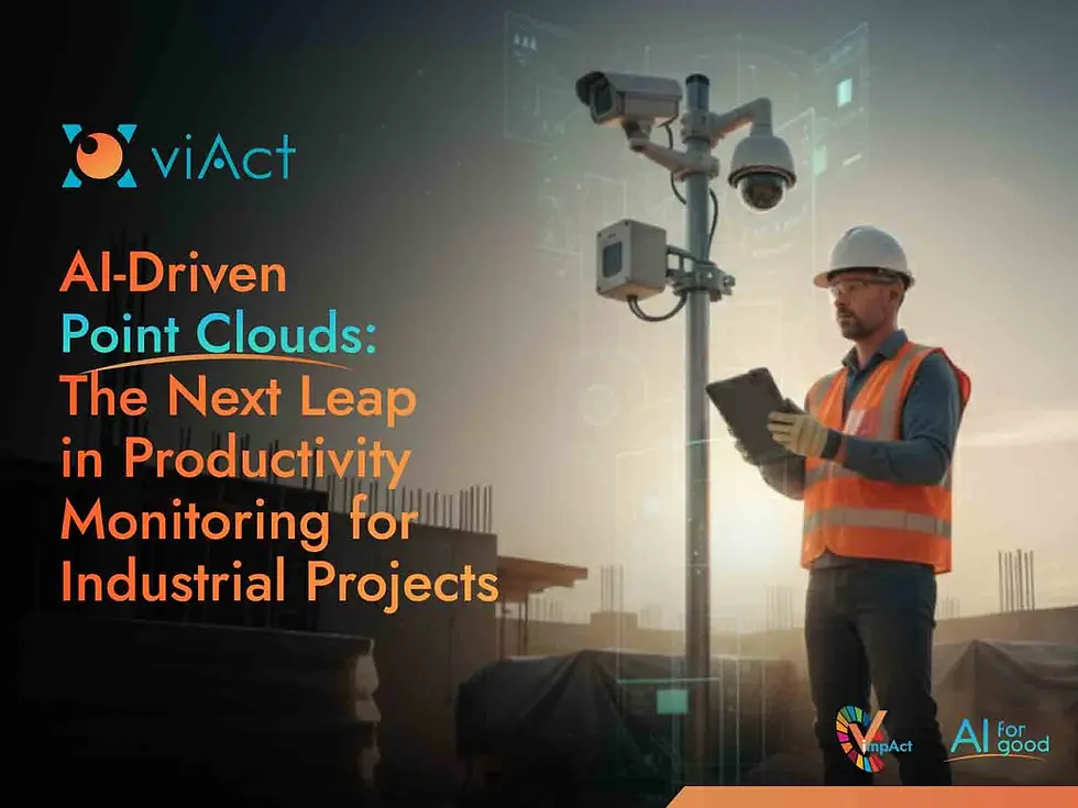
The Setup: Fix-Poled LiDAR with Cameras
Imagine four tall poles, one at each corner of a construction site.
Each pole is equipped with 360-degree LiDAR scanners and high-resolution cameras.
Together, they continuously capture and stitch the site into a 3D model—updated every 30 minutes.
Unlike drone surveys that depend on flight schedules, this setup ensures non-stop monitoring. Every pile of material, every vehicle, every shift in the landscape is recorded in near real time.
Consider the construction of a bridge in Hong Kong. Traditionally, supervisors and project managers would conduct weekly surveys to measure foundation depth or deck alignment. With fixed-pole point clouds, the bridge’s progress is continuously updated in a digital twin, showing if piling depth matches plans or if structural beams are positioned correctly—days earlier than manual inspections would reveal.
Phase 2: From Visualization to Industrial Productivity Monitoring

A digital twin can be highly useful in construction safety, but it’s only data. The leap towards eventful transitions happen when AI begins analyzing the point cloud for real-time productivity monitoring and extract insights around it.
What AI Does with Point Clouds?
AI when collaborated with point clouds transforms the process of monitoring into precise activities, such as -
Detection - AI detects and labels key site components in the point cloud—workers, excavators, cranes, scaffolding, material stacks, or even temporary formwork. This identification is the foundation for deeper productivity insights.
Classification - Once objects are detected, AI classifies them into states. For example, equipment is flagged as active vs idle, while materials are tagged as delivered vs installed. This categorization tells managers not just what is on site but how it is being used.
Comparison - AI cross-references the evolving point cloud with the planned Building Information Modeling (BIM) design. This comparison highlights discrepancies in installation, delays in task completion, or even sequencing errors such as a wall is installed before rebar is placed.
Essential Use Cases in Construction Productivity
Project managers often struggle with maintaining a consistent productivity across sites. A uniform measurement that automatically considers situational factors is useful and that is why construction sites need AI and not just CCTVs in 2025. Today, AI integration with point clouds broadly facilitates -
1. Material Tracking
Materials are the backbone of construction schedules. With AI merged, point clouds don’t just show that materials have arrived on the site—they verify if they are placed in the correct zone or have already been installed. In large infrastructure projects like metro rail construction, supervisors had to walk the storage yard, checking if everything was in place.
Now, LiDAR perimeter monitoring knows when a segment is unloaded, whether it’s stacked in the right zone, or if it’s already been installed underground. If a piece is moved unexpectedly, the system flags it. This not only prevents theft but ensures the right material is exactly where it should be.
2. Machine Utilization
Heavy machinery often represents one of the most expensive resources on-site. AI detects whether excavators are actively digging, cranes are lifting, or if machinery is simply idle. This insight reveals if costly equipment is being underutilized, helping managers optimize resource allocation.
Picture a road construction project, the paver is laying down asphalt, but the roller meant to follow right behind is standing still, engine idling. LiDAR based monitoring catch this in real time—showing managers the exact moment machines fall out of sync.
3. Workforce Monitoring
Productivity often comes down to labor allocation. AI point cloud analysis can map worker density across zones such as, during a tunnel lining operation, it can flag if only half of the required workforce is present inside the shield, delaying progress.
Suppose, inside a tunnel shield, the schedule says 50 workers should be on-site, carefully aligning and bolting tunnel segments. But today, only 20 are there. To the naked eye, this mismatch might not be obvious until much later, when delays stack up. AI, however, reads worker density in the live 3D map and highlights the shortage instantly.
4. Task Completion Validation
AI can track progress on specific activities—like formwork erection, rebar fixing, or concrete pouring—and validate how much of the planned task is complete versus pending.
In high-rise projects, construction rise floor by floor, panel by panel. On one such project, glass façade panels gleam on the skyline. The plan says 60% of the panels should already be fixed, but in reality, only 40% are up.
Instead of waiting for a manual report, AI paired with LiDAR spots the lag automatically. The digital twin reflects the gap, prompting managers to adjust—perhaps rushing material delivery or redeploying more crews.
Phase 3: Forecasting Progress with AI Dashboards
Once productivity is tracked reliably through point clouds, the natural next step is forecasting—moving from “what is happening now” to “what will happen next.” This phase is crucial because it shifts construction management from fixing delays to preventing them before they escalate.
How AI Forecasting Works
AI ingrained in the LiDAR based safety solution doesn’t just capture snapshots of progress; it learns from patterns in the point cloud data over time. By combining live data with historical trends, resource availability, and BIM schedules, it creates a standard work procedure for the project.
A centralized dynamic dashboard containing the amalgamated data across the cameras showcases trends, safety scores and upcoming risks in a visually intuitive way. This means project managers no longer rely only on gut instinct or weekly status meetings—they have data-driven predictions at their fingertips.
Key Applications of AI Forecasting using Point Clouds
1. Schedule Forecasting
AI uses point clouds to continuously compare live site conditions with the planned BIM schedule. The strength of this lies in its ability to show the domino effect of delays. On a bridge project, for instance, if excavation slips by two days, AI immediately reveals how that will ripple through to formwork, rebar installation, and eventually concrete pouring.
Rather than waiting weeks to see the impact, project managers can adjust sequencing, bring in extra crews, or redeploy machinery right away to stay on course.
2. Automated Reporting
Reporting has always been a time-consuming task for supervisors, but AI simplifies it by generating daily or weekly updates automatically. These aren’t just text-heavy documents—they come with 3D visualizations that clearly separate completed work from pending areas.
In a weekly project review, stakeholders can see a digital twin glowing in green for progress and red for pending tasks. Discussions become quicker, evidence-driven, and free from the delays of manual compilation.
3. Regulatory Alignment
Design integrity is another area where AI forecasting proves critical. By overlaying live point cloud data with BIM, the system checks whether construction matches the approved model in real time. Even the smallest deviations are flagged. On a high-rise site, for example, a wall just a few centimeters off can be caught immediately before it compounds into costly rework across multiple floors.
4. Resource Planning Insights
Finally, AI with LiDAR transforms how resources are allocated. By analyzing live 3D maps, it forecasts whether the current mix of labor, equipment, and materials is sufficient for upcoming deadlines.
On a housing project, for instance, AI might forecast that the team laying bricks on one block is moving slower than expected. If this pace continues, the roofing crew scheduled for the following week would be left waiting. By spotting this early, managers can either reassign extra workers or shift the roofing schedule, keeping the overall project timeline intact without unnecessary downtime.
Phase 4: Beyond Productivity – Safety on the Construction Site
While productivity is a top driver for adopting point cloud with AI solutions, safety remains the non-negotiable foundation of every construction site. A single lapse can halt projects, escalate costs, or worse—risk lives. That’s where point clouds play a dual role: not just monitoring progress, but acting as a live safety shield.
By combining point cloud data with AI, EHS teams in construction sites gain real-time visibility into high-risk situations, creating a digital safe system of work.
Safety Use Cases with Point Clouds and AI
Imagine a busy construction site, crane swings overhead, forklifts move pallets of steel, and sparks fly from welding nearby. In such a setting, even a small oversight—like a worker stepping too close to the crane’s swing path or scaffolding that shifts slightly out of alignment—can quickly escalate into a serious accident.

This is where point clouds paired with AI make a difference. By mapping every detail of the site in 3D and layering intelligence on top.
Here are some of the most important safety use cases where AI and point clouds work hand in hand:
Safety Use Case | How It Works | Role of LiDAR Point Clouds | Role of AI |
Detects workers near crane swing zones, forklifts, or heavy equipment. | Creates precise 3D spatial map of moving equipment and worker positions. | Analyzes distance thresholds, predicts collision paths, and triggers alerts. | |
Identifies individuals entering restricted zones without permission. | Maps site boundaries and restricted zones in 3D. | Detects and verifies human entry, cross-checks against access permissions. | |
Scans scaffolding, shoring, and formwork for irregularities or deflection. | Captures millimeter-level structural geometry and deviations. | Classifies irregularities as risk indicators and prioritizes areas for inspection. | |
Verifies helmets, vests, and harnesses in high-risk zones. | Provides clear depth and body contours for worker detection. | Detects PPE presence/absence using visual patterns and compares with safety rules. | |
Maps open edges, floor openings, or missing barricades. | Creates elevation models highlighting edges and drop zones. | Identifies workers approaching hazard areas without fall protection. | |
Detects material piles near welding or wiring near water. | Maps material and equipment placement in spatial context. | Analyzes patterns for hazardous proximity. |
Future of AI-Driven Point Clouds for Construction
The future of AI-driven point clouds in Hong Kong is heading toward fully autonomous construction monitoring—sites that can continuously scan, analyze, and optimize themselves with minimal human intervention. Instead of relying solely on manual inspections or periodic reports, fixed pole LiDAR and AI systems create a seamless 360-degree view of site activity, refreshed in near real time.
This integration eliminates blind spots, accelerates progress verification, and ensures that decision-making is driven by objective data rather than assumptions.
For construction professionals, the implications are profound. Projects are under constant pressure from compressed schedules, escalating costs, and heightened safety expectations. AI-powered point clouds transform sites into dynamic digital ecosystems where productivity metrics, safety risks, and quality benchmarks are all monitored in real time.
Construction has long been defined by materials, machinery, and manpower. But the future introduces a new pillar: Intelligence.
Quick FAQs
1. Can AI point clouds integrate with our existing BIM models?
Yes. The AI overlays 3D point clouds onto BIM models to automatically detect deviations, measure progress, and flag misalignments. Integration ensures seamless progress tracking, clash detection, and quality assurance.
2. How do I deploy AI-driven point cloud systems on a construction site?
Deployment for providers such as viAct typically involves:
Installing fixed LiDAR + camera poles at strategic corners (minimum 4 per site).
Connecting sensors to an AI analytics platform via secure network protocols.
Calibrating the system with existing BIM models for accurate overlay.
Training the AI to detect equipment, materials, and workers for productivity insights.
3. Is it difficult for project managers to adapt to AI-enabled 3D visualization?
Not at all. Here is a feedback for viAct AI-based construction progress tracking with LiDAR from a Hong Kong high-rise project:
“The dashboard is intuitive, and the AI highlights exactly what we need. It is very easy to navigate and locate what we need. We no longer spend hours interpreting reports.” – Senior Project Manager, Construction Firm
Training sessions are short (1–2 days), and the system is designed to complement existing workflows rather than replace them.
4. Can EHS teams use LiDAR-based site monitoring?
Absolutely. AI helps the EHS teams detects:
Workers near risky areas like crane swing zones or open edges.
Unauthorized access to restricted zones.
Structural irregularities.
Dashboards provide real-time alerts, reducing incident response time by up to 70% according to client case studies.
5. Is AI point cloud technology cost-effective for construction projects?
Yes. While initial setup requires investment in poles, LiDAR, and AI software, benefits include:
Reduced delays and rework.
Enhanced safety compliance and fewer incidents.
Accurate progress tracking for timely payments and milestone approvals.
Clients often report ROI within the first 6–12 months on large-scale projects.
Are you intrigued with the LiDAR based AI-Driven Point Clouds for Construction?
Read More:


This is a very insightful post. Using AI-driven point clouds for productivity monitoring in industrial projects shows how technology is transforming efficiency and decision-making. The way complex ideas are explained here makes it easy to understand their real-world impact. In many fields, including creative work with a Customized Pvc Patches Maker precision and attention to detail are just as important for achieving high-quality results.
The perception surrounding games https://plinko-pk.net/ did not change all at once. It was the result of a steady and understated process that wove them into regular digital activity. Today they coexist with social media, video services, and other content without carrying the same sense of contrast as before.
Maybe this normalization indicates something more profound: a long-term adjustment to a culture where digital life functions as the default setting.
Great insights on how technology enhances construction accuracy and planning. Integrating smart tools really transforms project outcomes and site safety. In the middle of future innovations, Book Publishing Company in Ireland shows how traditional industries also benefit from digital evolution, proving that adaptable strategies drive success across diverse professional fields today.
Seeing how LiDAR point clouds and cameras come together to create accurate 3D views of construction sites in Hong Kong shows how fast the industry is evolving. It’s helpful not just for safety but also for better decision making on site. For those documenting such work, research paper editing services can be useful to clearly present technical insights and real project outcomes.
Drive into the world of racing mods at theapkasphalt.com. The Apk Asphalt offers verified downloads of Asphalt Nitro and Asphalt 8 mod APKs—safe, fast, and 100% free to enjoy.